Clusters latitude/longitude values with zoom in capabilities. Comes present with a number of tile providers, including the ability to add your own custom tile and Web Map service as well as custom GEO JSON overlays. Requires latitude and longitude values in the dataset, unless you code your own map using the Custom JavaScript Handler. This can be used on-premise without internet connectivity to point to your own mapping service/tile provider. For datasets without latitude/longitude, see geocoding features in Cloud9QL.
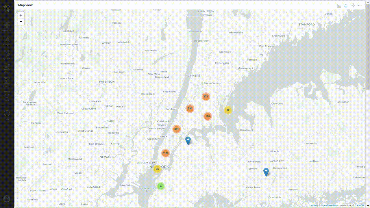
Chart Configuration
| Field |
Interpretation |
| Center Latitude |
Map center latitude |
| Center Longitude |
Map center longitude |
| Zoom Level |
Map zoom level |
| Marker Pin Text |
To display the text on the marker when clicked |
| Tile Provider |
Geo tile provider for a look and feel options |
| Point Styles |
Display points as cluster groups, simple pins, or heatmap |
| Count Field |
If you have lat/long points with a weighted number field |
| Marker Color Field |
Customize marker color, where the field selected contains the marker color to display |
| Field |
Interpretation |
| Title Font Color |
Set the title font color of the widget |
| Title Font Size |
The default title font size is 14px. |
| Field |
Interpretation |
| Show Title |
Show Title on Widget |
| Analyze |
Show Analyze menu |
| Alerts |
Show Alert icon |
| Filters |
Show Filter icon |
| Drilldowns |
Show Drilldowns menu |
| Query |
Show Query menu |
| Data/Export |
Show Data/Export menu |
| Data Diagram |
Show Data Diagram |
| Share |
Show Share menu |
| Refresh |
Show Refresh menu |
| Maximize |
Show Maximize menu |
| Remove from Dashboard |
Show Remove from the Dashboard menu |
Other
| Field |
Interpretation |
| Custom Tile Provider |
Custom tile provider URL |
| Custom WMS |
Custom layers URL |
| Custom Map Layers |
Layers names |
| GeoJSON URL |
Optional GeoJSON for additional layering |
| GeoJSON Code |
Optional GeoJSON for additional layering |
| Custom Javascript Handler |
Optional Javascript for additional handling |